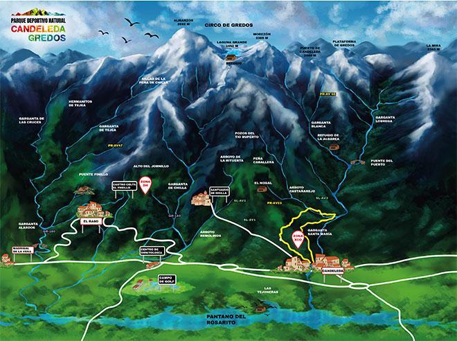
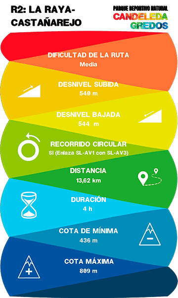
R2: LA RAYA-ARROYO DE CASTAÑAREJO


This is a long route that runs through pine and chestnut woods. It links the Chilla path (SL-AV 1) with the Los Pescadores path (SL-AV 3).
It is a circular route. In the first part there is hardly any water, in contrast to the second section where the Castañarejo stream is with us for almost the whole route.
We recommend doing the route in a clockwise direction, that is to say, starting the ascent along the Chilla path up to the top of La Raya, from where we will take the junction.
Just before taking the junction, there is a fountain on the left of the path and immediately afterwards we will see a lanscape viewpoint with the valley at our feet..
From there we will go through oak clearings and pine forests through the most representative gallery forest of Candeleda, which is next to the Arroyo de Castañarejo.
The most emblematic species include the Montpelier maple.
We will go down the stream to its mouth, in the Garganta de Santa María, where we will join the Senda de Pescadores.
From here we can only follow the path towards Candeleda, where our proposal ends, but not before refreshing ourselves at the Fuente Fría, that we will find along the course of the path
DATA AND PROFILE

TOPOGRAPHIC MAP

DOWNLOAD YOUR TRACK HERE