R2A: COMARCA DE LA VERA ROUTES PUERTO EL PIORNAL

On road, there are as many routes as each of us wishes to create. They are not signposted, therefore you should bring with you a GPS device with the track (which can be downloaded down here), a map or a really clear idea about the points you should be targeting. We propose routes that end and start from Candeleda and that go throught the most popular ports in this area.
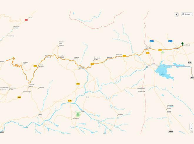
Candeleda is located only 10 km away from Extremadura, to be precise from the region of La Vera. There are a lot of routes that can be taken in order to visit the region. We propose several options:
Route: Candeleda – Madrigal de la Vera – Villanueva – Valverde – Losar – Jarandilla – Aldeanueva – Cuacos de Yuste – Jaraíz – Pto. Del Piornal and the return will be trough the same route we went.
The whole road of La Vera is an all tie up and down and it also goes across many villages where you can drink or eat in any restaurant.
At the entrance to Jaraíz de la Vera, if you turn right to the village of Garganta la Olla, you will begin officially the Puerto del Piornal; which will be the biggest obstacle on this route. The return will be trough the same route we went.
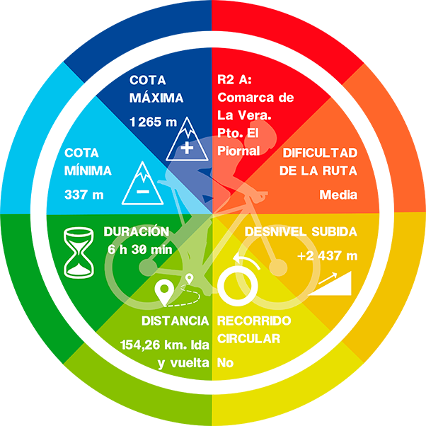
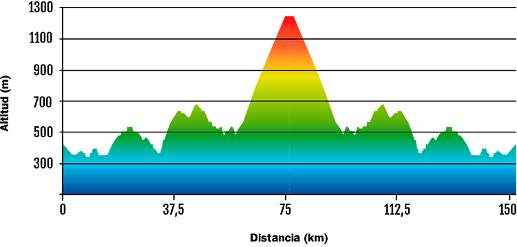
-Km: 154 km.
-Slope: 2.400 m.
-Puerto del Piornal data: 13,3 km; 692 m (positive slope) and 5,2% average gradient.
DATA AND PROFILE
DOWNLOAD YOUR TRACK HERE