R1: SANTUARIO DE CHILLA
![]()
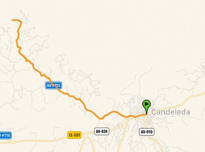
On road, there are as many routes as each of us wishes to create. They are not signposted, therefore you should bring with you a GPS device with the track (which can be downloaded down here), a map or a really clear idea about the points you should be targeting. We propose routes that end and start from Candeleda and that go throught the most popular ports in this area.
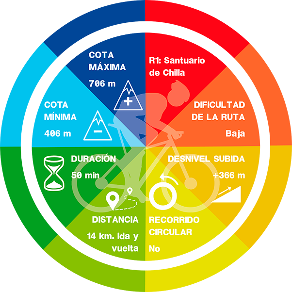
Route: Candeleda – Santuario de Chilla – Candeleda
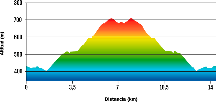
It would be a very attainable route because of the number of kilometres to be covered (go and back 14 km). However, the climb is very challenging as it reaches about 310 m of positive height gain.
It starts in the town of Candeleda and it runs along a well-surfaced road with amazing views from its highest point. The downhill must be done with caution, taking into account that the road is narrow and has plenty vehicle transit.DATA AND PROFILE


